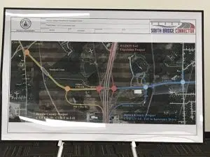
BROWN COUNTY, WI (WTAQ) – The location of Brown County’s South Bridge Connector has been confirmed. The Wisconsin DOT and Federal Highway Administration signed off on the final Final Tier 1 Environmental Impact Statement and Record of Decision last week.
“Instead of being able to say, ‘This may be where it’s going in the future,’ for the first time, now that this is signed, we can say, ‘This is where it’s going to go’,” said
Brown County Planning Director, Cole Runge. “The primary goal of the tier one study which is finished is to identify the general location of where the southern bridge and the connecting streets will go and we’ve done that…The next step then for the rest of the corridor is to identify the exact alignment, and again, people have an opportunity to review and comment on that process as well.”
The Record of Decision identifies the location of the South Bridge Connector, which will begin at Packerland Drive (County Highway EB) in the Town of Lawrence, continue along a new road to a new Interstate 41 interchange, and follow Southbridge and Red Maple Roads to the Fox River. The connector will then cross the Fox River and follow Rockland Road and a new road to reach the intersection of County Highways X and GV in the Town of Ledgeview.
“The county is going to focus, for the next year or so, on completing section one of the project – which is going to be between Packerland Drive in Lawrence and Lawrence Drive in De Pere. And that will include the I-41 interchange,” Runge told WTAQ News. “The county right now is working with the state DOT on finishing up the state’s environmental study for it’s I-41 project in Brown County and Outagamie County. And then we’ll focus on working with the state on the design and ultimately the construction of that first section.”
The new Interstate 41 interchange at Southbridge Road that will be designed and constructed as part of WisDOT’s Interstate 41 project in Brown and Outagamie Counties.
The construction of an actual bridge over the Fox River is still a few years out.
“With the tentative schedule put together for the entire corridor, we may be looking to put the bridge in somewhere in around 2028-2029 at this point. But that will depend on the availability of funds at the local level, but also at the state and federal levels,” Runge explained.
“This is the most significant breakthrough in the past 30 years,” said Brown County Executive Troy Streckenbach. “Now that the location of the Southern Bridge Arterial corridor is set, it gets us one step closer to providing for economic development opportunities, improving infrastructure, and increasing safety for southern Brown County.”
“I would like to congratulate the engineers, environmental staff, and project planners with Brown County, FHWA, and WisDOT on their hard work to finish these key project documents,” said WisDOT Secretary Designee Craig Thompson. “WisDOT remains committed to assisting you with this important transportation infrastructure project in Brown County.”
The South Bridge Connector Final EIS/ROD will be available beginning Monday, October 26th on the South Bridge Connector website. Printed copies of the Final EIS/ROD will also be available beginning Monday, October 26 at the De Pere branch of the Brown County Public Library, Brown County Planning and Land Services Department, Brown County Public Works Department, and WisDOT Northeast Region Office on Vanderperren Way in Ashwaubenon.
Brown County is the lead agency for the South Bridge Connector Project. FHWA and WisDOT are currently assisting Brown County with a Tiered Environmental Study.


